The Valley gets a fresh sip
Once or twice a year we load up the Conestoga with salt pork and
hard tack and make the journey into the great unknown of the
Central Valley.
Actually, we toss some camping or snow gear into the back of the
car and head toward the Sierra Nevada.
The Valley gets a fresh sip
Once or twice a year we load up the Conestoga with salt pork and hard tack and make the journey into the great unknown of the Central Valley.
Actually, we toss some camping or snow gear into the back of the car and head toward the Sierra Nevada.
In spite of being able to cross the Great Valley in less than two hours in air-conditioned comfort, it still feels like a journey.
We live tucked in among the world’s most beautiful hills. Our communities are embraced by the Gabilan and Diablo ranges. But the Central Valley is different. Not far east of Los Banos, the mountains evaporate into the haze, the horizon straightens out and wraps itself around the traveler, and one might very well be in Iowa.
I don’t like it. Rather than openness, I feel as if the landscape is closing in.
But the lure of the Sierra justifies the pain and suffering of the Central Valley.
It’s not just the vastness of the Valley, but the thought of what it was and what it’s become. After passing the 1,000-acre fields of cotton, we soon pass the abandoned shacks that mark forgotten dreams. More than anywhere else we’ve visited in California, much of the valley seems to have been regarded as a place to consume. When the dream doesn’t work, well, just move on.
There’s also the memory of the Valley that opened itself to settlers in the 19th century. John Muir wrote of his first view of the expanse. He was plodding over Pacheco Pass when the vista opened. Spread before him was the shining beacon of the Sierra, and at his feet was a carpet of flowers 400 miles long – the Central Valley.
Ferry boats once plied Tulare Lake. The Valley was a seasonal sea, nourished with snowmelt and impossibly verdant and fertile.
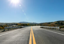
Today’s drive does have its highlights. There are a few stops that we usually make on the way. There’s the endless row of palm trees that marks the arrival of Chowchilla. And there’s the bridge over the San Joaquin River.
The “river” always brings a smile, because during the summer months, it’s always an arid, sandy wash.
But that’s about to change.
A story by Glen Martin in Wednesday’s edition of the San Francisco Chronicle announced a settlement this week that will result in the restoration of the San Joaquin.
Once a ribbon of cool water filled with salmon, the San Joaquin today is described as California’s hardest working river.
Born at the foot of Devil’s Postpile near the summit of the Sierra, the San Joaquin drains a vast section of that mountain range. In its upper reaches, it is a wild river. I’ve hiked it and fished it for years. Our oldest daughter was just a kid when she caught two German brown trout in its waters within the space of a few minutes. Both were 16 to 18 inches long, with deep, powerful bodies – and that’s no fish story.
Along its way, it is repeatedly dammed – Edison, Florence, Huntington, Mammoth Pools, Shaver and Millerton all capture the watershed’s flow – tapped for its power and diverted for agriculture that grows a cornucopia in a desert.
By the time it reaches the valley floor, the San Joaquin is all but spent.
But after 18 years of acrimonious litigation, the San Joaquin will be reborn.
Our trips to the mountains often pass just below the enormous Friant Dam, a concrete monolith more than 300 feet tall that contains the entire flow of the river in Millerton Lake.
According to the settlement, water management staff now will be required to release enough water to ensure that the San Joaquin flows to the sea.
That’s not just good news for tree huggers. The increased flow should help improve the quality of drinking water for Central Valley cities along the river’s course.
Even farmers who depend on the river’s diverted waters say they can continue to prosper by using water more carefully.
Martin quoted Kole Upton, a farmer and chairman of the Friant Water Users Authority, as saying that the agreement represents the best kind of compromise.
“The important thing here is that we now have partners in restoration and mitigation, not adversaries,” he said. “That makes all the difference.”
As we cross the San Joaquin River bridge on Highway 152 next summer, I’ll be looking for that water, and I’ll have a new reason to smile on my journey through that vast valley.


