Getting Out: Imagine standing there, your hiking shoes snugly
laced, at the foot of an imposing earthen mass. Your head is tilted
far back, but your view of the sky is obstructed by a whole lot
of
”
up,
”
and going there is the next thing on your to-do list.
Imagine standing there, your hiking shoes snugly laced, at the foot of an imposing earthen mass. Your head is tilted far back, but your view of the sky is obstructed by a whole lot of “up,” and going there is the next thing on your to-do list.
For many, the upcoming climb will cause the heart to race with anticipation. What view waits at the top? What surprises are concealed on the other side? For others, nausea and light-headedness will develop, and you will be reminded of previous commitments that cannot wait.
You will know one of these feelings as you stand at the foot of the Boccardo Loop Trail in Sierra Vista Preserve; 1,600 vertical feet rise before you, a daunting prospect. But a difficult task is the price one pays for an extraordinary reward.
The Santa Clara County Open Space Authority, besides wonderful Rancho Canada del Oro Preserve, has one other preserve open to the public: Sierra Vista. It rises behind Alum Rock Park and can only be reached through the park. So, while the preserve is free, you are subject to Alum Rock Park hours and fees in order to access it. The SCCOSA website warns that Alum Rock Park is closed on Mondays (therefore, so is the preserve), and there is a $6 per-vehicle day-use fee. But on the Thursday afternoon that I visited, no fees were collected.
Opened in 1872, San Jose’s Alum Rock Park is the oldest municipal park in California. It is a long narrow park that follows a deep riparian valley cut by Penitencia Creek. Throughout the length of the park, lovely grounds and picnic areas are set among huge sycamores, alders and bigleaf maples that line the creek. Old grottos and bridges made from local stones remain from a hundred years ago when the mineral springs here drew thousands of tourists.
Alum Rock Park’s meager signage offered little assistance finding the North Rim Trail and Sierra Vista. I finally requested the help of a park visitor who set me on the correct path. At the end of Penitencia Creek Road is a parking lot near the Youth Science Institute. The way begins immediately beyond the end gate, where a paved road turns hard to the left and edges up the hill. Where the paved road turns back to the right, I continued straight ahead onto a dirt path. Finally, I had found the North Rim Trail and was headed in the right direction. After a half mile, junctions to the right will appear. Any one will get you onto the Todd Quick Trail which leads to the Boccardo Loop Trail and Sierra Vista.
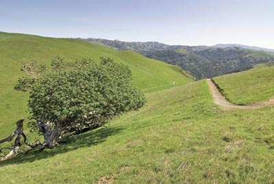
As I rose slowly up the North Rim Trail, the sound of the raucous creek and children playing began to fade. At the gate to the preserve, Alum Rock Park had disappeared, and there rising abruptly overhead was 1,100 feet of bald, grassy “up.” From there, the 3-mile loop, an old ranching road, took me steeply up and around this huge hill. Each puffing step revealed more of the South Bay and the neighboring hills.
From the top, the view was spectacular in every direction. On a perfectly clear day, I am sure the preserve earns it name. To the south, I looked across the web of creases in the Diablo Range that collects water and channels it down to Penitencia Creek. What a view of Silicon Valley! An information panel at the summit helped me pick out landmarks across the South Bay.
Bring your legs and your lungs. You will need them both. It is a bit of effort but quite a prize.


