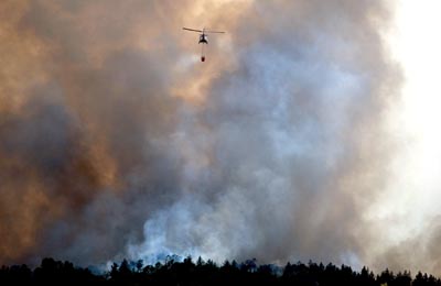
The Calfire San Benito/Monterey Unit had a controlled burn
Tuesday on 1,650 acres near McPhail Peak at the end of Limekiln
Road.
The Calfire San Benito/Monterey Unit had a controlled burn Tuesday on 1,650 acres near McPhail Peak at the end of Limekiln Road. The peak, located 14 miles west of Salinas, is at an elevation of 3,000 feet.
A San Benito County fire official said it was to burn fuel.
“It’s a means of hazard fuel reduction,” Marlow said.
A press release for the event states that due to the size and location of the burn, smoke might be present for several days.
The burn was scheduled to commence on Sunday at 9 a.m., but due to weather conditions, Calfire waited until Tuesday to begin.


