Since the closure of Fort Ord in 1994, the 28,000 acres that comprised the military base have been spun off into various civilian uses. As a part of that process, on April 12, 2012, President Obama signed a declaration setting aside 14,650 acres—half of the former base—as Fort Ord National Monument. The Bureau of Land Management currently oversees 7,200 acres, and the remainder will be turned over to the BLM once the military completes environmental remediation.
Where the Salinas Valley reaches Monterey Bay, a vast level plain separates Big Sur’s Santa Lucia Mountains from the Gabilan Range. On the pancake-flat agricultural outskirts of west Salinas, I drove south on Davis Road through huge fields of green salad fixings. Up ahead, across much of the horizon, the lands of Fort Ord National Monument rose as a level stretch of upland bluffs perhaps 100 feet above the farm lowlands. When I reached the foot of the bluffs, I turned left onto Reservation Road and just before it reaches Highway 68, I turned onto Portola Road and followed it a mile or so to the Creekside Trailhead.
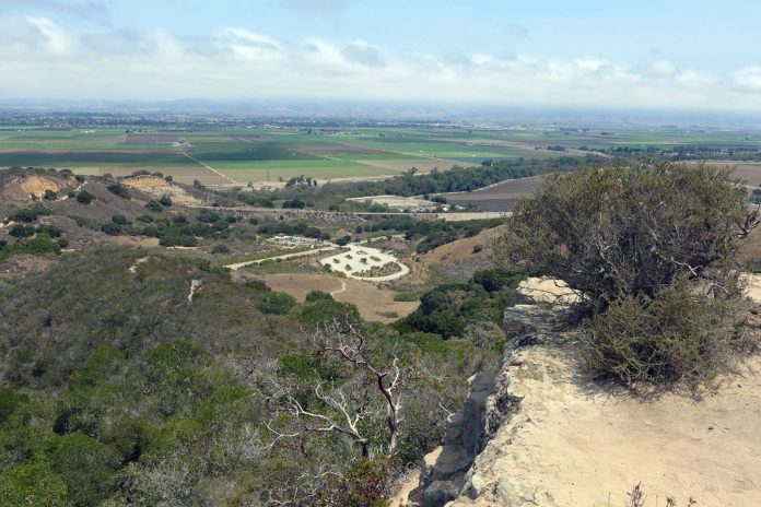
The map of the national monument indicates several access points, but the Creekside Trailhead is the quickest approach to an impressive web of trails. The parking area is at the foot of the bluffs, so job No. 1 was getting up top. I walked up Old Reservation Road, an old paved road now closed to traffic, to Sandy Ridge Road and soon found myself taking in a view that covered all of northern Salinas Valley. From the sliver of Monterey Bay I could see on the left, the valley view stretched across a checkerboard of farm fields to Fremont Peak and then disappeared behind the Santa Lucia Mountains as it turned south to Soledad and points beyond.
From my vantage point on Sandy Ridge Road, I could see that the lands of Fort Ord National Monument were a jigsaw puzzle pattern of bluffs divided through the ages by a network of small drainages. The main trails at Fort Ord are old dirt roads that run along the ridge tops or through the canyon bottoms and are interconnected by a tangle of foot paths.
Since Sandy Ridge Road traced the ridgetop, I stayed with it. As far as I could see, maritime chaparral plants cloaked the bluffs. Large manzanita bushes and coast live oaks rose above a head-high tangle of coyote brush, chamise, poison oak and coffeberry. In our inland hills, coast live oaks clump up with suckers and branch out in a rather uninspiring way. But as I have noticed elsewhere along the Monterey coast, the trunks and branches of live oaks at Fort Ord curled and turned with an elegant wind-twisted artistry.
Sandy Ridge Road petered out when the bluff did and it was time to cross a small drainage and climb the next one. In the valleys, thickets of bracken ferns and lacey draperies of lichen hanging from the trees broke the monotony of the chaparral above. I turned back along Jack’s Road, another paved road closed to traffic, that had great expansive views west toward Toro Regional Park and the prettiest landscape of the day.
The trails at Fort Ord National Monument are ideal for mountain bikers, and dog lovers will appreciate that their pets can explore off-leash. Don’t expect a special landscape or an enticing destination, but you will find many miles of pretty trails, and on my weekday visit, once I left the parking area, I saw only one other person.


