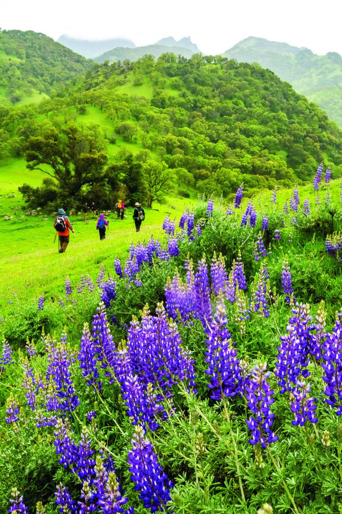
One of California’s most curious and intriguing landscapes is hidden in plain sight. You have certainly driven past it but may never have noticed it. And if you have, I suspect your reaction was like mine: What the heck is that, and what is it doing there?
In northern California, the Sacramento Valley stretches on and on through hundreds of monotonous agricultural miles. As you drive up Interstate 5, the coast range defines the western margin of the valley; to the east rise the Sierra. But these major mountain ranges are on the distant horizon many miles away.
Near the town of Williams, a clump of impressive peaks suddenly poke through the valley floor; not soft round peaks, but steep-sided mountains topped with jagged rock ramparts that tower 2,000 feet above the surrounding farm lands.
What is this clump of mountains doing in the middle of the Sacramento Valley? Their beauty and unlikely presence always called to me. It wasn’t until I found Middle Mountain Interpretive Hikes that I was finally able to answer the call.
Middle Mountain Interpretive Hikes, with the cooperation of landowners (all Sutter Buttes land is private property), offer a variety of guided interpretive hikes into Sutter Buttes throughout winter and spring. Whatever your interest: natural history, human history, photography, peak-bagging, and more, Middle Mountain Interpretive Hikes has a day trip to suit you. Peaks and views call most insistently to me, so I signed up for the hike to the summit of the North Butte.
Community Memorial Museum in downtown Yuba City was bustling with hikers for several Sutter Buttes outings when I arrived on a threatening Saturday morning. A handful of miles northwest of town, our carpool caravan reached the edge of the buttes and the first in a succession of ranch gates we would pass. Quickly, we were enveloped in a landscape that seemed like anyplace but the Central Valley. Through a lush oak-studded grassland, we bobbed and weaved into the heart of the buttes property; the peaks a thousand feet overhead. So beautiful! My passengers and I commented that we would have gladly paid the trip fee just for the lovely ride in.
From our parking spot at 600 feet elevation, we looked up at the craggy summit of North Butte 1,200 feet overhead. Charlie, our hike leader, decided we would head straight for the summit to hopefully beat the coming rain. We crossed a gentle apron of oak grassland to the foot of a chaparral-dotted gully that offered a passable route between sheer rock ramparts on each side.
Up, steeply up. No trail, just look carefully for a stable next footfall. Finally, the top. Yet higher rock outcrops and a tangle of foliage hid the views. But with a bit of scrambling, there they were. The coming weather made the distant views all the more dramatic. As one view corridor closed, another opened. No Shasta or Lassen, but Mount Diablo and the Sacramento skyline were crisp on the horizon.
Back at the bottom, now in steady rain, we gathered around a large Native American grinding rock with several mortar holes. Long time local resident, Mike Hubbartt, shared with us his passion for the Buttes. Is it any wonder Sutter Buttes was a holy place to its first residents? Why else, but for the Great Spirit, would this unlikely circle of mountains be here?
All the “pretty” we had seen was just the beginning. Come again, Mike urged, and you will begin to touch the many facets of Sutter Buttes.


