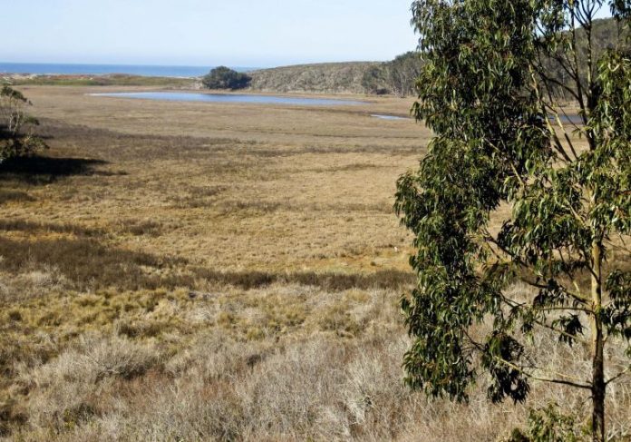
Every time I drive along state Route 1 between Half Moon Bay and Santa Cruz, I can’t help but think of all the things I am surely missing. On one side, curious country roads – Gazos Creek Road, Bean Hollow Road – beckon as I pass by. On the other side, I know that one beach after another is hidden at the base of the cliff beyond the few cars parked at a succession of unmarked access points.
My 1982 edition of Tom Taber’s “Santa Cruz Mountains Trail Book” is woefully out of date, so I picked up a used edition from 2006. While the book essentially duplicates information in other peninsula and South Bay trail guides, it includes one valuable and unique feature: a coastal access guide that covers every beach from Pacifica to Watsonville.
With this as my guide, I decided to cruise up the coast to take a closer look.
According to Taber’s book, Pescadero Marsh is the largest wetland between San Francisco and Monterey Bay. At the junction of state Route 1 and Pescadero Road, 15 miles south of Half Moon Bay, Pescadero Creek and Butano Creek join forces to create a beautiful estuary and an inviting setting that screams to be explored.
I am not a bird watcher. Nevertheless, occasionally I do enjoy watching birds. No luck so far, but each year I hope to elevate my proficiency from utterly ignorant to ignorant. I know that winter, wetlands and birds go together, so I grabbed my field guide and binoculars, and I set out.
Pescadero Marsh is a State Park Preserve that touches state Route 1 along a 1-mile stretch where the road drops down from the top of the seaside cliffs to near ocean level. There are three short out-and-back trails that leave from three different parking locations – the north end, middle and the south end. The requirement to pay a parking fee at the north parking lot sent me back to the middle lot, where the hiking options looked better. From there, I walked a short way along the highway before dropping down to the beach where the creek crosses under the freeway and heads out to sea.
The Sequoia Audubon Trail begins here, and I would soon rejoin it, but I couldn’t resist the urge to follow the sandy edge of the creek. Fishermen were trying their luck for steelhead that spawn here. I identified several Bufflehead ducks diving for food, and I slowly circled a white-tailed kite perched in a bush lupine. I have seen them in flight, but never like this. The eyes of this mostly white raptor have a sleek black streak like a Goth teenager that creates an I-mean-business look.
Other than an occasional alien eucalyptus, few plants grew higher than my waist to obscure the spacious setting. I walked past rushes, blackberry bushes, stinging nettle, buckwheat and common yarrow as I crossed back to the Sequoia Audubon Trail. Lots of egrets, deer, cottontails, and red-tailed hawks were my companions.
Not pressed for time and in a wandering mood, I twisted slowly up Pescadero and Alpine roads to Skyline Boulevard atop the Santa Cruz Mountains.
In all, it made for a perfect day. Even your friends who are allergic to hiking will love the level stroll through Pescadero Marsh.


