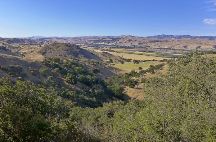
We have the good fortune to live in a region where trails into the peace and serenity of open space are just moments from home. When I am asked for my favorite, it’s tough to choose. There are just too many. But the Arrowhead Loop at South County’s newest open space preserve is a top candidate.
On Saturday morning, June 27, the Santa Clara Valley Open Space Authority hosted guests and dignitaries to officially open Coyote Valley Open Space Preserve to the public. This 348-acre preserve climbs the hills on the west side of Coyote Valley at the end of Palm Avenue four miles north of Morgan Hill and two miles south of Bailey Road on Santa Teresa Boulevard.
When summer heat pounds our local hills, there is little to recommend a midday hike. But at the edges of the day, the cooler air and the soft warm light can combine for a pleasant and beautiful outing. With this
in mind, Renée and I met two friends at 5:30 one evening to walk the four-mile loop that traces the perimeter of the preserve.
Beyond the parking lot, the Heart’s Delight Trail and the Arrowhead Loop Trail start out on a side-by-side track, and with other similar looking pathways close by, I wasn’t exactly sure which trail was which. The trail you choose will determine which direction you travel the loop. We were outside a cattle fence and entered through the first gate which set us on the Arrowhead Loop Trail. A second gate up ahead leads to the Heart’s Delight Loop and a counterclockwise track around the preserve. “Mind your hay bales” was the other lesson I learned. Two hay bales at the entrance to a pathway mean this is not the way.
We followed the Arrowhead Loop Trail up a dry creek bed before doubling back and turning toward the nose of a ridge and our first look across the valley. A very nice view, but it was only a hint of what was to come. Turning, twisting, the trail continued to climb toward the ridgetop. Kudos to the SCVOSA trail builders. This serpentine path is an elegant corridor past bay trees, buckeyes already dropping their leaves, and four species of oaks, some with trunks so gnarled and twisted that you are tempted to ask them out for a beer just to hear their stories.
A mile and a half out, we reached our second scenic overlook bench and an ever-widening view. Two miles out, half way around our loop, we reached our high point, 600 above the valley floor, and we began an extended traverse along the ridgetop. Keep an eye out for a narrow view toward Cinnabar Golf Course and Calero Reservoir on the other side. Pausing at another bench, we sat and marveled at the full length view of Coyote Valley beneath
Mount Hamilton, Coe Park’s Pine Ridge, and the heights of the Diablo Range, all growing sweeter as the sun dipped and the light softened.
To be honest, I didn’t expect much from this loop. After all, what could dazzle us in these familiar foothills? Maybe it was the time of day or the clear air, but dazzling it was. I tip my hat to the SCVOSA for carving a path that does a great job of showing off the preserve and Coyote Valley. The best part; it’s just minutes from home.


