The names we give our man-made structures often come from the surrounding landscape. But we have so urbanized our environment that those names have often lost their meaning. I confess that when someone says ‘Stevens Creek,’ I think of a boulevard and not a creek. It makes perfect sense, but I remain a bit skeptical that there is such a thing as a creek with that name. I decided to investigate.
Stevens Creek ends its journey at San Francisco Bay just north of Moffett Field in Mountain View, but by that time, it is a trapped and tamed version of its former self, vastly different from the creek Juan Bautista de Anza camped beside in 1776. On its way down the mountains, the creek pauses for a rest at Stevens Creek Reservoir. But above the reservoir, eight miles of the creek runs much as it did when de Anza came through.
After a quick look at a map of Monte Bello Open Space Preserve, it was clear that the best way to see an extensive portion of upper Stevens Creek is to find a friend and arrange a car shuttle. Since I was alone, I had to create a loop, and whichever I chose, it would be a long day. I decided to begin my hike at the small Grizzly Flat Trailhead along Skyline Boulevard, three miles north of Highway 9.
Morning dew still sparkled on the trees and shrubs as I stepped into a virtual rain forest at the top of Grizzly Flat Trail. Douglas firs, bigleaf maples, and black oaks were some of the trees that wrapped around me as I began a 1,000-foot, 2.5-mile descent to the creek. After such a dry winter, I took heart at the sight of blooming milkmaids by the trail. A narrow view corridor opened in the trees over toward Black Mountain, the hulk that forms the other side of the watershed across the valley. What a huge expanse of wild land such a short distance above Mountain View and Sunnyvale!
Near the bottom of the trail, keep an eye out for a signed trail junction just above the creek. If you miss it, and continue to the creek along the same path, you will see that there is no trail on the other side.
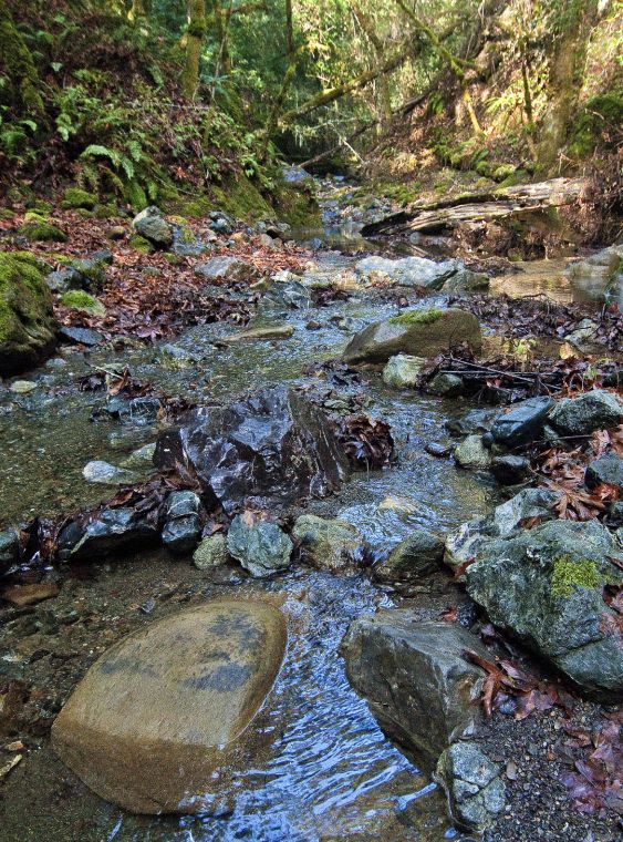
There is was: Stevens Creek. Not the boulevard, but a beautiful splashing stream. Sunlight filtered through the tight canopy onto hillsides covered with ferns and the creek gently twisting through rocks covered with moss and maple leafs—a beautiful moist antidote to a dry winter.
Beyond the creek, I joined the Canyon Trail that follows the course of the creek up to its source. Now, I was on the south-facing slope of Black Mountain. Coast live oaks and bay trees replaced the moisture loving Douglas firs and maples I had passed down the shaded slope on the other side.
I had to regain the thousand feet I had just dropped, but the grade up the Canyon Trail was gentle and pleasant the entire way. The loop I chose (nine miles in all) meant a left turn at a succession of trail junctions until I finally walked up Skid Road to Skyline Boulevard, nearly three miles away from my car. I headed back along the Ridge Trail in Skyline Ridge Open Space Preserve across the road—an uninspiring walk through a Christmas tree farm except for an encounter with bobcat along the way.
If you need new shoes, head for Stevens Creek Boulevard, but if you need a break, you will find one on Stevens Creek.


