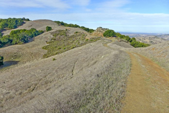
On my previous visits to Calero County Park, I have always walked the lower portions of the park nearer the reservoir. This terrain bobs and rolls over round hills dotted with coast live oaks, valley oaks and bay trees. As you move away from the lake toward the park’s southern boundary, the Bald Peaks ridge leaps 1,000 feet above the reservoir. From that high perch, the full sweep of the Bay Area spreads out beneath you.
I have been to Bald Peaks several times, but always from the Rancho Cañada del Oro side, the open space preserve that abuts Calero County Park along that ridge. On a bright day before the holidays, I awoke feeling full of piss and vinegar, and I decided that it was a good day to explore the high route at Calero.
My only rule at Calero is to begin every hike on the Figueroa Trail. The other trails that begin across from the parking lot are old farm roads that needlessly climb and descend over steep rolls that make you gain the same elevation over and over. While the Figueroa Trail begins a little too close to McKean Road, it’s gentle right turn follows a creek bed that quickly takes you away from the road and into a lovely wooded glen.
A mile and a half out, I turned left at the trail junction I had always passed, the Cañada del Oro Trail. In addition to the name, the park map makes one other notation on this trail: steep. I can confirm the map’s accuracy. Over the next mile, I rose 600 feet to the Bald Peaks Trail and began a wonderful ride along this beautiful high ridge.
Bald Peaks is truly one of the special promontories in our beautiful backyard. At every compass point, the horizon was a long distance away and the landscape before it was spectacular. As I rolled along the grassy ridgetop, in front of me the peaks of the Santa Cruz Mountains, including Loma Prieta and Mt. Umunhum, reached high overhead. On the left, I looked over the lands of Rancho Cañada del Oro toward the southern hills disappearing in the distance. Behind me, El Toro, and the Diablo Range from the Hollister Hills to Coe Park to Mt. Hamilton to Mt. Diablo. And on my right, the Bay Area—all of it. On this crisp day, I could distinguish the Bank of America building and the Transamerica Pyramid in the jagged San Francisco Skyline. Beyond the Bay Bridge, my old backyard, Mt. Tamalpais.
The ridgetop ride ended nearly a mile later when I turned onto the Chisnantuck Trail and began to slide down the slope toward the far end of Calero Reservoir. The setting on this trail was never boring, alternating forests of oak (three species), bay and buckeye with open grassy fields. Just before turning toward home, I came to the Cottle Rest Site, a great spot for lunch. From the picnic table there, I looked down toward a creekbed at two huge leafless sycamore trees. Twisting in the elegant artistic way that only a sycamore can, the tree’s naked white branches were a striking contrast against the dark foliage beyond.
The Cottle Trail turned right and followed Cherry Canyon Creek toward the reservoir. I was about five miles out and as far from the parking lot as I would get. The lower section of the Javelina Trail began the route home.
I wish these trails had been built for hikers rather than long gone ranch vehicles. The Javelina/Pena Trail route I followed gained, lost and regained elevation time and again over steep paths that meet the requirements of a rancher, but needlessly tire a hiker—even one who started with lots of piss and vinegar.
On a morning when you get up brimming with energy, consider burning it on this eight-mile loop that encompasses all of Calero County Park from Bald Peaks to the reservoir. If you can, pick a day after a storm has blown through and scrubbed the air clean. The parking area is on McKean Road south of Calero Reservoir and about a half-mile south of the intersection with Bailey Road. There is no day-use fee. Dogs are permitted on a leash on all trails north of Bald Peaks Trail.


