San Benito County officials at 12:26pm Jan. 9 issued an evacuation notice for properties in northern portions of the county.
Residents who live on Lovers Lane between Highway 152 and Shore Road are being asked to “evacuate immediately” due to flooding in the area, says the county’s press release.
The alert warns of a “significant threat to life or property.”
An evacuation point for the affected residents has been established at the Hollister Veterans Building, 649 San Benito Street, according to county staff.
The county further specified residents of the following areas should be prepared to evacuate immediately due to the severe weather:
– San Felipe Road from CA156 to County Line
– Lovers Lane
– Lake Road
– Dunneville Estates and portions of Shore Road from San Felipe Road to Frazier Lake Road.
“Gather your household members, pets, personal items, important documents, prescription medications, change of clothes, non-perishable foods, water, extra batteries, flashlights and phone chargers,” says an alert from the county issued at 12:54pm Jan. 9. “Prepare to evacuate to a safe location.”
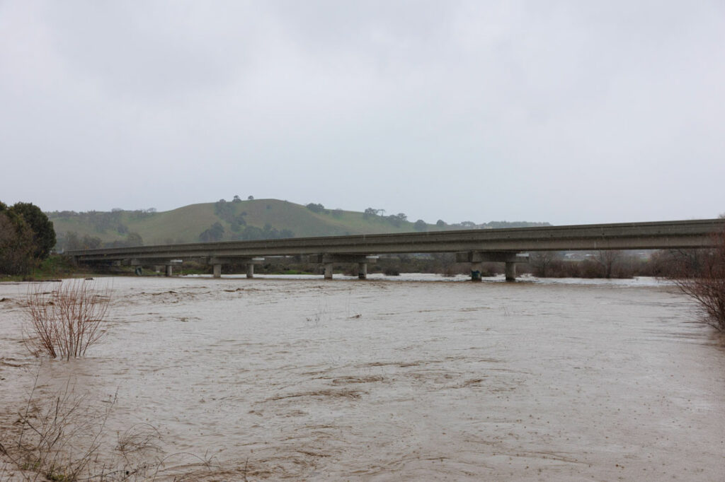
Pouring rains from the current storm, which started the night of Jan. 8, have resulted in local flooding and road closures throughout San Benito County and South Valley.
The county and National Weather Service on Monday morning also issued a wind advisory that is in effect through 4pm Jan. 10. Southwest winds of 15-30 mph, with gusts up to 45 mph, are expected during the advisory period.
The threat from the wind advisory is categorized as “moderate” with a “possible threat to life or property,” says another press release from county officials.
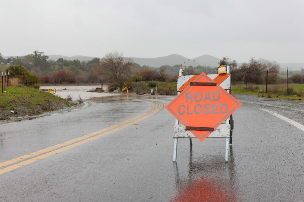
Motorists are urged to use caution while driving, and avoid flooded roadways and areas under flood warnings when possible, says the press release.
Roadways approaching San Benito County from multiple directions are closed or under flood warnings as of Monday morning. Floodwaters spilling over Highway 101 around noon Jan. 9 forced officials to shut down the southbound lanes of the highway at Mesa Road in Gilroy late Monday morning.
Bolsa Road is also flooded between Travel Park Circle and Carnadero Avenue.
Recent rains and saturated ground conditions are adding to the runoff feeding Uvas Creek, according to City of Gilroy officials, creating potential flooding in low-lying areas.
The following roads are closed or experiencing flooding:
• Westbound 152 Hecker Pass
• Castro Valley Road
• Mesa Road
• Bolsa Road
• Wren Avenue
• Mantelli Road
• Burchell Road
• Miller Avenue at Silva’s Crossing
Low-lying areas of potential flooding include:
• Daly’s/Velado Mobile Home Park and businesses near the intersection of Monterey Street and Luchessa Avenue
• The Gilroy Garlic RV Park and Holloway Drive Area
• Travel Park Circle, including the Garlic Farm RV Park
• Businesses and residences along Southside Drive
• Residences in the Hyde Park, Stratford Place area
• Oak Place Development roadways may be flooded, but the home pads are built a foot above the 100-year flood level.
San Benito County officials will continue to notify residents via email and social media of flood warnings, evacuation notices and other hazards throughout the current and incoming storms. Those warnings and updates can be found on the following San Benito County accounts:
– Facebook: San Benito County-Government https://www.facebook.com/sbccalifornia/
– Instagram: @SanBenitoCounty https://www.instagram.com/sanbenitocounty/
– Twitter: @SanBenitoCounty https://twitter.com/SanBenitoCounty
– Nextdoor: https://nextdoor.com/agency/san-benito-county/?i=gntyrppgfkzcwjfswyfc
People can also sign up for Code Red Reverse 911 notifications, county officials added. The Santa Cruz Regional 911 uses the CodeRED community notification system to send messages to residents, businesses and visitors within Santa Cruz and San Benito Counties in the event of emergency situations or critical community alerts.
Sign up by texting SCR911 to 99411 to enroll.
Furthermore, the San Benito County Sheriff’s Office and Office of Emergency Services will send any emergency notifications through Nixle. These notifications will include but are not limited to:
– Flood Alerts
– Evacuation Warnings
– Road Closures
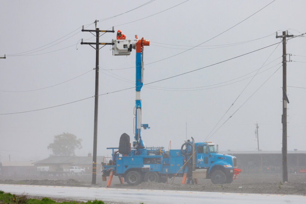
– Power Outages
Additional resources listed by San Benito County officials include:
– Ready: Ready is a National public service campaign designed to educate and empower the American people to prepare for, respond to and mitigate emergencies, including natural and man-made disasters. The goal of the campaign is to promote preparedness through public involvement. Ready.gov
– CalOES: https://www.caloes.ca.gov/
– National Weather Service: forecast.weather.gov.