Since the 1960’s, the Midpeninsula Regional Open Space District has worked to protect open space in northwestern Santa Clara County and southern San Mateo County. Twenty years ago, realizing the need to extend protection to the rest of Santa Clara County, the Santa Clara County Open Space Authority was created by an act of the California legislature. They have been busy ever since.
If you are a regular reader of this column, you know about Rancho Cañada del Oro, SCCOSA’s beautiful preserve south of Calero County Park in the shadow of Loma Prieta Mountain. In 1998, SCCOSA purchased Blair Ranch, adding 865 acres to the southern end of Rancho Cañada del Oro. Before this new land opens to the public, SCCOSA must perform resource inventories and build improvements to meet the needs of visitors.
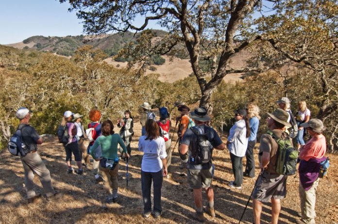
Teri Rogoway, SCCOSA’s Coordinator of Interpretive Programs, is an enthusiastic ambassador for the Authority’s lands. More than once, she has offered to set up hikes into yet unopened properties under the guidance of a docent. I took Teri up on her offer and on a recent Saturday, a small group set out to explore Blair Ranch.
The staging area for Rancho Cañada del Oro is several miles out Casa Loma Road that turns off of Uvas Road where it changes names to McKean Road not far from Cinnabar Golf Course. Casa Loma Road traces a valley where a number of small creeks on the flank of Loma Prieta join forces to create Llagas Creek as it begins its journey to the Pajaro River and ultimately Monterey Bay. From the parking lot, visitors to Rancho Cañada del Oro cross the road and walk trails north of the parking area. Blair Ranch begins on the other side of the creek and climbs the hills that separate Llagas Creek from the headwaters of Uvas Creek that follows Uvas Road on the other side.
Kathy Dollard, the docent from SCCOSA who would accompany us, met our group at the locked gate on the Uvas Road side of the property. Blair Ranch is still a working ranch and home to the Blair family, so it was important that we come and go with the least possible disturbance to the operations there.
Like many park lands with a cattle ranching history, the trails are old ranch roads that assail the slopes directly and steeply. No gentle hiker-friendly gradients here. Up we went through forests of valley oak, coast live oak, bay, and buckeye. In the clearings, aromatic tarweed and vinegar weed blossoms lined the road. You have to respect any plant offering lovely blossoms after nearly nine months of heat and drought. Buckeye trees that last spring were covered with palm-like leaves and showy white inflorescences, stood bare naked except for lone chestnut-like seeds dangling at branch end.
Higher up, we emerged into a clearing and turned to look through the bright fall haze across Uvas Creek below us toward the back side of El Toro and the Hamilton Range beyond. On and up we went through chamise and coyote brush until we stood on top of the divide and looked down on the Rancho Cañada del Oro parking area on the other side.
The time is coming, when through the work of the SCCOSA, other land trusts, and county parks, we will be able to walk from Blair Ranch to Calero County Park to Almaden Quicksilver County Park to Sierra Azul Open Space Preserve and emerge at Lexington Reservoir without touching pavement or passing a habitable structure. All this within minutes of seven million people.


