San Francisco Bay joins forces with the city skylines, the fog and the bridges to create one of the world’s most dramatic metropolitan settings. For many of us, that is where our thinking about the bay itself ends.
A recent viewing of the fantastic KQED four-hour documentary “Saving the Bay” ignited my desire to know more. In particular, I wanted to learn more about the primeval bay, before Europeans came and changed it forever. What would it have looked like?
“Saving the Bay” contributors described a vast wetland with shallow shores bordered by cattails and bulrushes. At low tide, vast mudflats would appear, and in some places, the width of the bay would shrink by half. Wildlife was everywhere, including grizzly bears, deer, mountain lions, tule elk and pronghorn. Shorebirds in flight would completely obscure the sky. Native Americans on the edge of the estuary thrived on abundant waterfowl, fish and shellfish.
I remembered that Coyote Hills, one of the East Bay Regional Parks, reportedly retains much of the character of the primeval bay. I had never visited Coyote Hills because its location – in Fremont at the east end of the Dumbarton Bridge – had little allure. But my new San Francisco Bay curiosity trumped my reservations about the park, so off I went.
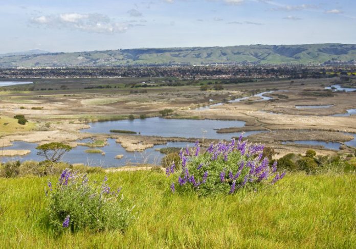
I hadn’t even reached the parking lot before I realized how wrong my prejudgments were. Hubbub is not far away, but I could neither see nor hear it as I drove past a vast collection of open sloughs nestled in a forest of bulrushes. Just across the road, separating the marshes from the bay, were the park’s namesake Coyote Hills, a rolling succession of green knobs that rise about 200 feet above the marshes.
Trails and boarded walkways crisscross the marshes, but eager to get the lay of the land, I scampered up the hills. I walked the full length of the Red Hill Trail that rolled up and over the hilltops. On my left, the edge of the bay was just beneath me – the beginning of a view of the full sweep of the bay basin. On the right, past windswept bush lupine and poppies at my feet, the beauty of this great marshland knocked me out.
The Red Hill Trail ended by the side of Alameda Creek, and I turned toward home on the Bayview Trail. Coyote Hills Regional Park is indeed a trip back in time to the original bay, but my few hours there left me yearning for all that is still waiting there to see and learn. The marshes are teeming with bird life. There is a 2,000-year-old Ohlone village site with shell mounds and other archeological remains.
My apologies, Fremont. I misjudged you. Behind the hills at the end of the Dumbarton Bridge, you are concealing a real gem.
Clouds Rest Challenge Update
Our third preparation hike for the Clouds Rest Challenge is on March 30 at Rancho Cañada del Oro. This is a moderately difficult hike in a lovely preserve. The full loop is 8.5 miles, but at the 3-mile mark, there is the option to follow the creek back to the parking lot making a shorter 4.3-mile loop. If conditions are right, those who do the full loop will enjoy views all the way to San Francisco. The trailhead is 2 miles out Casa Loma Road off of Uvas Road, where it becomes McKean Road, a few miles south of Cinnabar Golf Course. See you there at 9 a.m. rain or shine.


