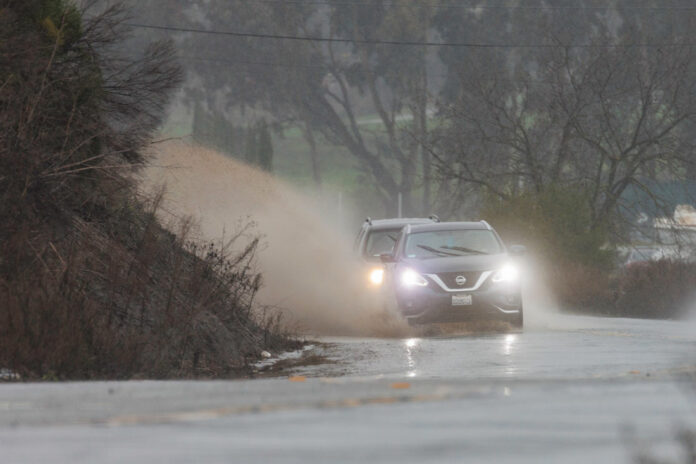
The latest weather forecast for Hollister might not include sunny skies, but some relief from the heavy downpours that have been characteristic of recent storms over South Valley might be on the way.
After the latest atmospheric river on Jan. 10 cleared the region there will be an “unsettled pattern” for a couple of days, National Weather Service Meteorologist Sean Miller said. Jan. 11-12 will see chances of rain from Morgan Hill through Gilroy to Hollister, with precipitation projections less than .25 inch.
Then, starting Jan. 13 and lasting through the weekend will be the “next stronger weather system,” Miller said. “It’s not looking on the order of what we just had (but) some areas could see a half inch to an inch of rain, or more.”
That storm will likely last through Sunday, Jan. 15, which marks the end of Miller’s Jan. 10 forecast period.
Temperatures through Sunday will be somewhat normal for the season, with highs in the upper 50s to 60, and lows in the upper 40s to lower 50s, Miller said.
San Benito County saw widespread flooding from the latest storm on Jan. 9-10, which pelted an already soaked landscape. The saturated ground, already drenched from an unusually wet winter, heightened the risk of flooding and other hazards.
Locally, this week’s storm resulted in multiple road closures—including a deluge of almost the entire length of Lovers Lane in northern San Benito County from which 23 people and 16 pets were rescued on Jan. 9. The area by Jan. 11 had been downgraded to an evacuation warning, with more rain in the forecast.
That evacuation warning includes the following areas:
– San Felipe Road from CA156 to County Line
– Lovers Lane
– Lake Road
– Dunneville Estates and portions of Shore Road from San Felipe Road to Frazier Lake Road.
Public safety officials said any residents who are still home in these areas should be prepared to evacuate immediately.
Highway 101 in Gilroy was shut down for more than six hours on Jan. 9 after Uvas Creek spilled over near Mesa Road, submerging multiple homes and turning the heavily traveled roadway into a slow-moving river. Highway 25 north of Hollister was reportedly briefly closed as well.
As of Jan. 11, other weather and flood-related road closures in San Benito County include San Juan Hollister Road, Southside Road at Bolado Road, Prescott and San Juan Highway, Panoche Road at Highway 25, Old Hernandez Road and Highway 129, according to an interactive map of the latest incidents posted by county officials.
That map can be found at tinyurl.com/3zdswjx3. The map also shows current power outages, which numbered about 80 customers as of Jan. 11.
San Benito County Public Information Officer Monica Leon said the county is focusing on efforts to keep as many residents updated on the changing weather and flooding situation as possible, through all available channels. That includes email and Nixle alerts, social media and Reverse 911 signups.
Those warnings and updates can be found on the following San Benito County accounts:
– Facebook: San Benito County-Government facebook.com/sbccalifornia
– Instagram: @SanBenitoCounty instagram.com/sanbenitocounty
– Twitter: @SanBenitoCounty twitter.com/SanBenitoCounty
– Nextdoor: nextdoor.com/agency/san-benito-county/?i=gntyrppgfkzcwjfswyfc
People can also sign up for Code Red Reverse 911 notifications, county officials added. The Santa Cruz Regional 911 uses the CodeRED community notification system to send messages to residents, businesses and visitors within Santa Cruz and San Benito counties in the event of emergency situations or critical community alerts.
Sign up by texting SCR911 to 99411 to enroll.
Furthermore, the San Benito County Sheriff’s Office and Office of Emergency Services will send any emergency notifications through Nixle. These notifications will include but are not limited to flood alerts, evacuation warnings, road closures and power outages.
Additional resources promoted by San Benito County officials include:
– Ready: Ready is a national public service campaign designed to educate and empower the American people to prepare for, respond to and mitigate emergencies, including natural and man-made disasters. The goal of the campaign is to promote preparedness through public involvement. Ready.gov
– CalOES: caloes.ca.gov
– National Weather Service: forecast.weather.gov.


